4. From Valsenestre to La Danchère via the Roumeïou pass
Description
- Before you leave the hamlet, turn left, following the sign « Lac Labarre et Col de la Romeiou ». The steep path rises sharply through rather rocky terrain.
- At 1,730 metres altitude, a footbridge crosses the stream La Fayolle. The path becomes less steep and rises in wide bends to the alpine pastures just below the Cabane de Combe Guyon (1,950 m). After crossing a steeper small glacial rock bar, the path follows a small valley bottom (slight incline) and goes on to traverse some rocky ridges. After a final steep section, you arrive at Lac Labarre. The Romeïou pass is on your left, just above the lake.
- When you reach the pass, the path follows the ridge for a few metres before dropping sharply on the Maslanne valley side. After a short, sharp descent, it runs northward for a long, virtually level stretch. It then snakes over a small ridge before traversing again, crossing over a wide ravine. This section of the path runs through very steep terrain. The path is good, but keep to it! Under the Rocher de la Grande Église, the path follows another small ridge and then, after running through a short winding section, it comes to the flat terraces above the Cabane de la Selle.
- You can go on to the Cabane de la Selle (spring) and then retrace your steps or immediately join the GR (2,020 m) which leads to the right towards the "Brèche du Périer". It follows a gentle incline among rocks, screes and grassy slopes. The view gradually opens up onto L’Oboui mountain and Le Dévoluy and the peaks surrounding the Malsanne valley. A final long traverse up terrain of black schist takes you to a ridge. Follow the ridge (cairn) southward. After descending a few metres, you reach the Brèche du Périer (sign).
- The path then drops sharply on the Lac du Lauvitel side. After a first steep scarp, the path become identifiable again and you soon reach Lac de Plan Vianney. After this, the path alternates between steep scarps and gentler sloping stretches. The path leads into forest cover and runs above Lac du Louvitel, edged by large screes.
- After crossing the footbridge across the stream L'Héritiere, the path follows the shore to the north end of the lake.
- At the fork, bear left. Where the La Rousse and Le Lauvitel streams meet, stay on the left-hand bank.
- When you arrive in La Danchère, cross the stream Le Lauvitel via a bridge and enter the hamlet.
- Departure : Valsenestre
- Arrival : La Danchère
- Towns crossed : Valjouffrey, Le Périer, Le Bourg-d'Oisans, and Les Deux Alpes
16 points of interest
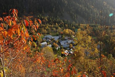
Valsenestre - Marion Digier - PNE  History
Viewpoint over the hamlet of Vasenestre
In the 19th century, the hamlet of Valsenestre had roughly one hundred inhabitants. The main activity was breeding. In 1851, a marble quarry opened in the bottom of the valley on the way up to the Muzelle pass. This was an opportunity for the village. It welcomed the quarry workers and benefitted from an improved road. Marble production stopped in 1905. Up until 1926, children laughing and shouting could still be heard in the village. The school had about thirty pupils. It was closed a few years later and the last permanent inhabitant of the village left in 1948.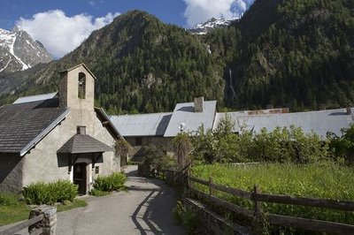
Le village de Valsenestre - Pascal Saulay - PNE  Architecture
Restored village
Valsenestre is a flower-filled village that has been superbly restored and is now made up of holiday homes The road is not cleared of snow in the winter. When the village had one hundred or so inhabitants it had a school (that has since been changed into a gîte d'étape (bed and breakfast halt), that closed in 1936. It was entirely buried by an avalanche in the 19th century. The main activity was still breeding but the opening of a marble quarry from 1840 brought complimentary resources to workers in the village. The last permanent inhabitant left Valsenestre in 1959.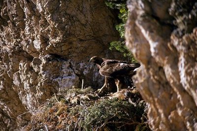
Aigle royal sur son aire - Robert Chevalier - PNE  Fauna
FaunaAlpine ibex and golden eagle
Reintroduced into the Valbonnais area in 1989 and 1990, the number of ibex is slowly increasing on the high summits of Valouffrey. A population of about fifty spend the winter on the well-exposed slopes of the Valsenestre valley. Some of them spend weeks on the rocky ledges of Peys above the village, waiting for brighter days. Some years, the golden eagle also comes to build its nest and raise its young. It is not rare to see it or hear it yapping above the footpath.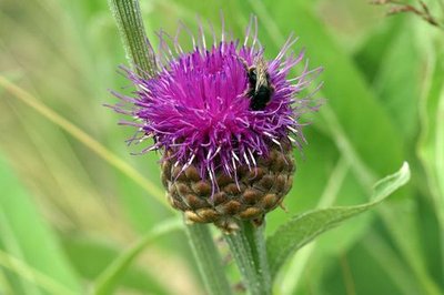
Rhapontique scarieux - Cédric Dentant - PNE  Flora
FloraGiant scabiosa
This giant of the subalpine lawn looks like and is the size of an artichoke? In addition, it has a large round deep pink flower head with a pearly rim. Its huge leaves, that are white and velvet-like on the underside, are impressive and make it easy to identify. Sound nutrition for several species of beetle, its flower head is also a treat for butterflies. This plant species is not common and is protected on a national level even outside the Park.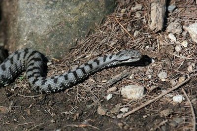
Vipère aspic - Jean-Philippe Telmon - PNE FaunaThe aspic viper
It has been a victim of legends and a bad reputation for centuries, but walkers that have been bitten are rare. This reptile that is, on average, fifty centimetres long, has a snubbed nose and a black, thin, vertical pupil, likes the well-exposed slopes. It seeks refuge in piles of stones and thorny thickets where it has no trouble catching small rodents and insects.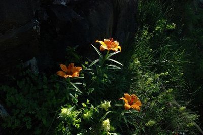
Lis orangé - Bernard Nicollet - PNE FloraOrange Lis
Due to its original and bright colour, it is easy to recognise on the steep terraces and rocky ledges. The orange lily is a rock lover that needs light and warmth, but not too much. This is why it blossoms at the beginning of summer to avoid strong heat. It is forbidden to pick it within the mountain National Parks, but also in several counties including the Hautes Alpes. Elsewhere picking is limited by decree.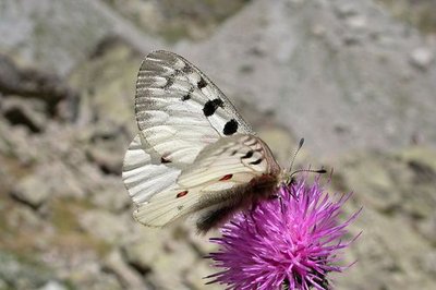
Grand Apollon - Christophe Albert - PNE FaunaMountain Apollo
One of the most beautiful butterflies you will come across in the mountains, its generally calm behaviour means it is easy to observe. It is linked to "camel" plants such as houseleeks that grow in dry conditions. They lay their eggs on this host plant, so that the larvae will be able to eat them.
Asphodèles - Pascal Saulay - PNE FloraWhite asphodel
They grow in groups, often accompanied by the yellow gentian, on the old hayfields, which have deep soil. Its tall candle-like appearance is easy to recognise and its flowers that are grouped together in a flower spike, blossom one after the other over several weeks at the beginning of summer. Its fleshy tuber attracts underground rodents. It was previously used in the form of flour, to feed the mountain people in times of food shortage.
Montée à Combe Guyon - Bernard Nicollet - PNE  Pastoralism
Combe Guyon pastures
They grow in groups, often accompanied by the yellow gentian, on the old hayfields, which have deep soil. Its tall candle-like appearance is easy to recognise and its flowers that are grouped together in a flower spike, blossom one after the other over several weeks at the beginning of summer. Its fleshy tuber attracts underground rodents. It was previously used in the form of flour, to feed the mountain people in times of food shortage.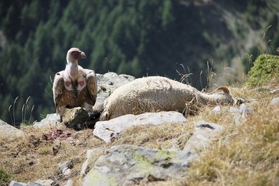
Vautour fauve - Marion Molina FaunaGriffon vulture
This enormous bird of prey, that has a span of almost three metres, is new to the mountains, thanks to a programme to reintroduce them dating from the end of the 20th century. In the summer, they swirl in the sky incessantly as a group looking for sheep corpses or other large wild mammals that they can tear apart for food. This impressive scavenger plays a welcome role in the healthy condition of the pastures.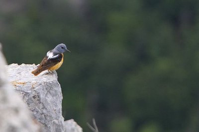
Monticole de roche - Pascal Saulay - PNE FaunaCommon rock thrush
Generally known as the rock blackbird, the male thrush stands out due to its bright contrasting colours and its melodic song. African in winter and alpine in summer, this magnificent migratory bird chooses open areas above the forests where it settles on rocky perches to sing and nests in the scree or other rocky nooks and crannies.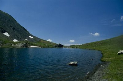
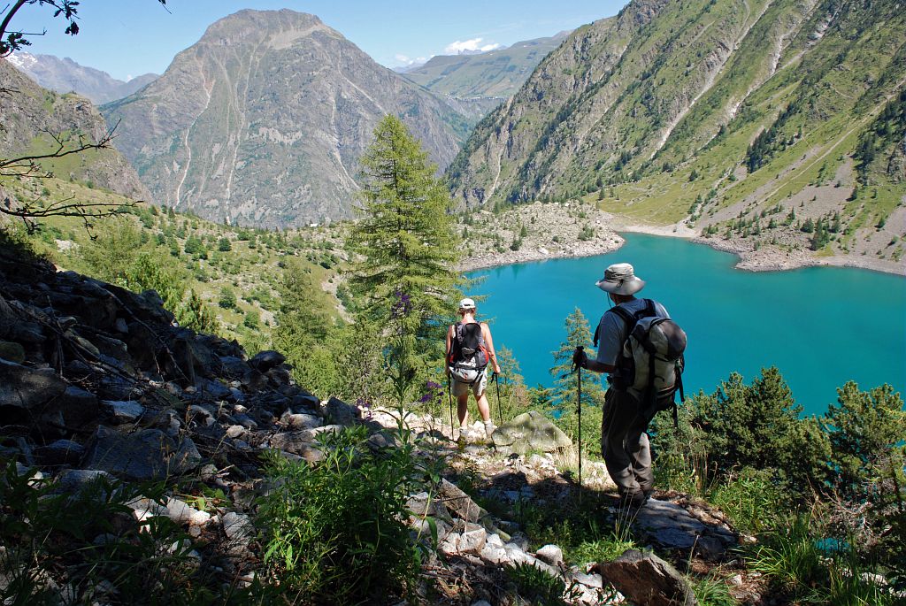
Le lac Labarre - Jean-Pierre Nicollet - PNE  Lake
LakeLabarre Lake
This medium sized lake, like many in the Alps, formed in the natural hollow or a cirque at the time of the great glacier retreat at the end of the 18th century. It was due to their force that, over time, they were able to sink into the soft rock and pass over the harder ones. Melt waters from the surrounding névé form runoffs filled with fine rock debris that flow into the one and a half hectare, 8 metre deep Labarre Lake. This is what gives it its distinct colour.
This medium sized lake, like many in the Alps, formed in the natural hollow or a cirque at the time of the great glacier retreat at the end of the 18th century. It was due to their force that, over time, they were able to sink into the soft rock and pass over the harder ones. Melt waters from the surrounding névé form runoffs filled with fine rock debris that flow into the one and a half hectare, 8 metre deep Labarre Lake. This is what gives it its distinct colour.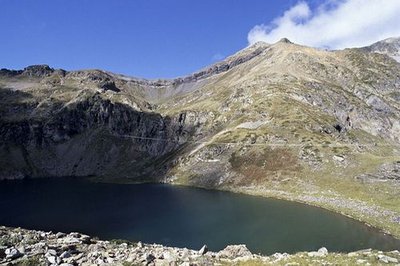
Le lac de Plan Vianney - Denis Fiat - PNE LakeLac de plan Vianney
The Plan Vianney lake is home to a good population of brook trout, also known as brook charr or speckled trout. Demanding concerning water quality, this species requires clear, cool well-oxygenated water. Here its reproduction is not through rearing. Fishing is not authorised by decree made the Ecrins National Park's director. Exceptions are made for fishing as part of scientific studies only.
 Geology and geography
Vaugnerites
On the footpath leading to the Plan Vianney lake, essentially in the coomb of l'Héritière, outcrops of vaugnerites can be seen. These are dark rocks containing many mica flakes. Chemically similar to lamproite (magmatic rocks with high potassium content), they form enclaves of different sizes from 10 cm to several tens of metres, in the Rochail granite.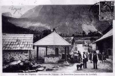
Le hameau de la Danchère - PNE ArchitectureDanchère Hamlet
With its paved lanes, its fountains and its stone wash-house, the Danchère offers an ideal starting point for going to Lauvitel which attracts 30 000 visitors every year. It is one of the numerous hamlets that make up the commune of Vénosc.
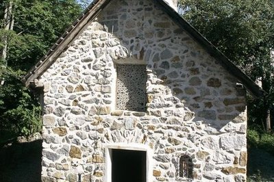
Les décharges de la chapelle de la Danchère - Cyril Coursier - PNE ArchitectureDanchère Chapel
Dedicated to Saint Louis and to Saint Claude, Danchère Chapel displays its agreeable proportions to visitors. The stones forming the arc of a circle above the entrance and the window do not only have aesthetic value. They are rightly called "a relieving structure" because they help to redistribute the weight of the facade on both sides of the openings. In the recess hidden behind wire netting is a ceramic statue of Saint Louis created in the Tarn region.
Altimetric profile
Sensitive areas
- Impacted practices:
- Aerial, Aquatic, Land, Vertical
- Sensitivity periods:
- JanFebMarAprMayJunJulAugSepOctNovDec
- Contact:
- Parc national des Écrins.
Golden eagle
- Impacted practices:
- Aerial, , Vertical
- Sensitivity periods:
- JanFebMarAprMayJunJulAug
- Contact:
- Parc National des Écrins
Julien Charron
julien.charron@ecrins-parcnational.fr
Golden eagle
- Impacted practices:
- Aerial, , Vertical
- Sensitivity periods:
- JanFebMarAprMayJunJulAug
- Contact:
- Parc National des Écrins
Julien Charron
julien.charron@ecrins-parcnational.fr
Recommandations

Information desks

Maison du Parc du Valbonnais
Place du Docteur Eyraud, 38740 Entraigues
Reception, information, temporary exhibition room, reading room and video-projection on demand. Shop: products and works of the Park. Free admission. All animations of the Park are free unless otherwise stated.
Access and parking
Short but non-exposed cabled stretch on the path that rises after Valsenestre.
There is a risk of snowfall at the beginning of the season, in which case crampons are an absolute requirement for the descent from the Romeïouou pass to Le Lauvitel (ravines).
Crossing the footbridge over the mountain stream L'Héritière could present difficulties in heavy rain and floods.
Source

Report a problem or an error
If you have found an error on this page or if you have noticed any problems during your hike, please report them to us here: