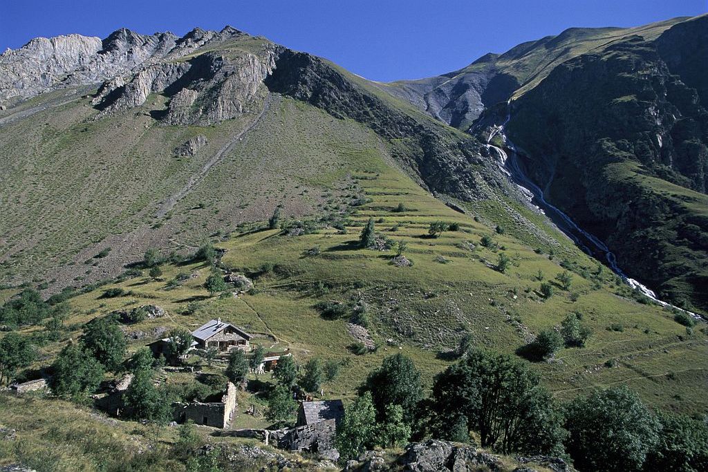
13. From Mizoen to the refuges of Les Mouterres and Le Fay
Description
- Then join the road and follow it for a few metres, and take a path on your right which will lead to the hamlet of Les Aymes.
- From the car park in this hamlet, located at a crossroads, turn right onto the road that runs downhill and then carry straight on along this track which will gradually turn into a path. Stay on the path, carrying straight on at the various little intersections.
- A few hundred metres beyond a small car park, take the path on the left which runs up the mountain side to a flat terrace.
- Here, at the first discovery path sign, turn left (faster route) or right towards the Lac du Lovitel. You will then come to the hamlet of Les Clots (1,540 m).
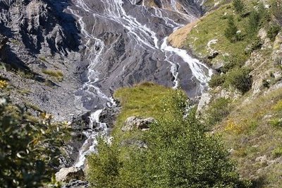
- Then, continue northwards following the La Pisse stream (be sure to follow the waysigns). Cross the upwelling area and continue uphill towards the east.
- Join a country track and follow it as far as the refuges of Les Mouterres and Le Fay (2,258 m).
- Departure : Mizoen - village centre
- Arrival : Refuges of Les Mouterres and Le Fay
- Towns crossed : Mizoën
4 points of interest
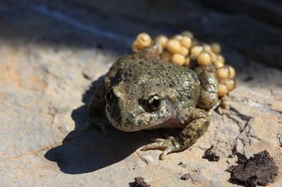
Alyte accoucheur - Marc Corail - PNE  Fauna
FaunaCommon Midwife Toad
In Spring, a short note emitted at regular intervals resonates around the lake. It is the mating season for this small terrestrial grey toad, mottled with black and brown; it is the male toad’s song to attract the females. A peculiarity of this anuran is that the male uses his back legs to surround the string of ova laid by the female to fertilize them with a jet of semen mixed with urine. In this way he watches over the eggs for several weeks. When they are on the point of hatching, he goes to the water and frees the young frogspawn.
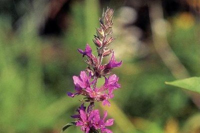
Salicaire - PNE  Flora
FloraPurple Loosestrife
During the whole summer, the Purple Loosestrife, with its beautiful purple spikes, sprinkles the small Lovitel lake with colour. Considered to be a weed to be destroyed, it does however hold a position among the most useful plants (plants with medicinal properties). Its astringent properties, among others, deem it to be a good remedy against colic in infants when teething. In the kitchen, its young shoots and the flesh of its stalks used to be consumed as a vegetable. The leaves could also be infused like tea.
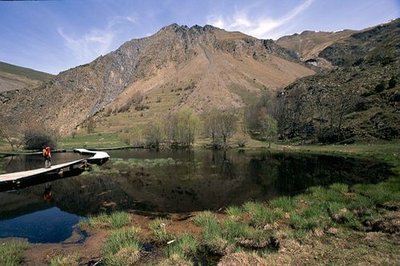
Le sentier de découverte des Clots, Mizoën - Cyril Coursier - PNE  Lake
LakeLovitel Lake
In addition to being one of the rare wetlands at altitude on the highest part of the Romanche, Lovitel Lake unusually partially dries out during the summer and turns in to a marsh. In this way it becomes ideal for the development of amphibians who benefit from the absence of fish, their predators. Furthermore, the ecological quality of the environment is remarkable... Several species of great natural value are present at this site, notably the Adder’s Tongue Fern and the Small Meadow Rue, both protected regionally.
Les Clots, la fontaine pétrifiante - Gérald Lucas  Geology and geography
Petrifying Fountain
The water that crosses the Emparis plateau which is composed of permeable sedimentary rock, fills up with Calcium bicarbonate. When, lower down, it comes in to contact with the impermeable crystalline rock layer of the Hercynien granitic base, the water follows a fault plane established between two layers and finishes in an aerial waterfall. The dissolved carbonates are transformed into a soft rock called Tuff by their contact with the air which has accumulated there for millennium. This resurgence, or petrifying fountain, is one of the most beautiful in France.
Altimetric profile
Sensitive areas
Short-toed snake eagle
- Impacted practices:
- Aerial,
- Sensitivity periods:
- MarAprMayJunJulAugSep
- Contact:
- Parc National des Écrins
Julien Charron
julien.charron@ecrins-parcnational.fr
Recommandations
Information desks

Oisans Park house
Rue Gambetta, 38520 Le Bourg d'Oisans
Video presentation of the natural resources of the Oisans mountain and its crafts. Information, documentation about the Park, projections, reading space for children. Accessible to people with reduced mobility. Free admission. All animations of the Park are free unless otherwise stated.
Source

Report a problem or an error
If you have found an error on this page or if you have noticed any problems during your hike, please report them to us here: