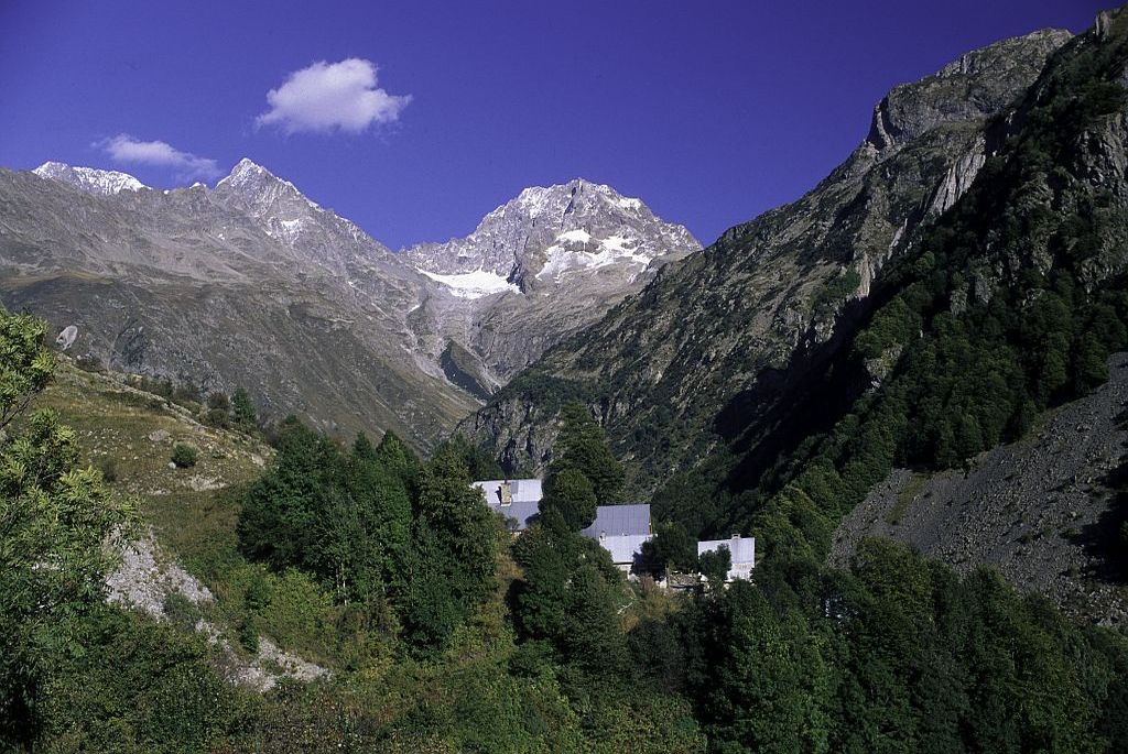
12. From Lac de Vallonpierre to La Chapelle en Valgaudemar (end of the GR)
Description
- Departure : Le lac de Vallonpierre, La Chapelle-en-Valgaudemar
- Arrival : La Chapelle-en-Valgaudemar
- Towns crossed : La Chapelle-en-Valgaudemar
15 points of interest
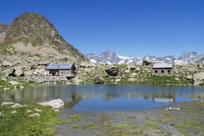
Le refuge de Vallonpierre - Dominique vincent - PNE  Hut
HutThe Vallonpierre refuge
A small lake, pretty meadows and the benevolent Sirac... This magical setting would lead to the construction of a refuge at an altitude of 2270 m in 1942. However, it was a victim of its own success and in 2000 the decision was made to build a second, bigger one. It can accommodate 37 instead of 22. This new building was the first modern mountain refuge to be built using stones on site rather than imported materials. It copies the simplicity and the crow-stepped gable from the "small refuge" which has been kept as lodgings for a warden's helper.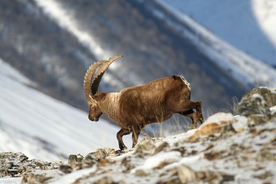
Bouquetin des Alpes - mâle - Jean-Philippe Telmon - PNE  Fauna
FaunaAlpine ibex
The species had almost completely disappeared from the French Alpine regions, and they survived thanks to our Italian neighbours, the kings of Savoy. Until the mid-15th century, they were still to be seen, but they were not wary of mankind and were hunted for their meat. Superstitious medical practice at the period also hastened their decline: their horns were ground into powder and used as a remedy for impotence, while the cross-shaped bone over their hearts was thought to ward off sudden death.
Successfully reintroduced into the Vanoise area in 1960, they were also brought back into the Champoléon valley over 20 years ago.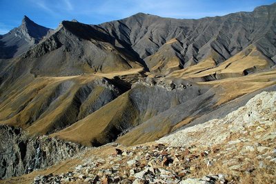
Vallon Plat, Col de Vallonpierre, Aiguille de Morges - Bernard Guidoni - PNE  Geology and geography
Impressive geology
From chabournéite, the native mineral of Valgaudemar, to the crystalline rock from the Sirac's gneiss, from the hollow of Vallonpierre made in sedimentary rock to the show that is given by the shale and tuffs on the Chevrettes pass, this circuit will take you back in time. The folds and the colours appear before you like an impressionist’s work of art.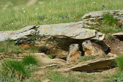
Marmottes à leur terrier - Mireille Coulon - PNE FaunaMarmot
A high-pitched whistle sounds in the mountain pastures it is the cry of the marmot on guard, warning its companions of the arrival of imminent danger from the sky. Any inattentive creature failing to take note should beware a golden eagle will carry them away in its talons to feed its young.
Native to the Alpine grassland, colonies of marmots live with their young until their third year. Gnawing and digging are their favourite pastimes, along with rolling down the slopes. And not forgetting an afternoon nap on a nice, warm rock and their long hibernation between October and March.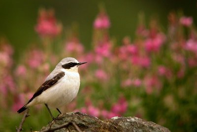
Traquet motteux - Damien Combrisson - PNE FaunaHigh altitude birds
Autumn is migration season. The mountains, which are too harsh in winter, loses their inhabitants. Some opt for a change in altitude and go lower down the valley or to the coast. This is the case for the alpine accentor, the redstart, the redpoll, or the Eurasian linette. Others head off on a long journey to warmer countries. The Sahara offers a milder winter to the common rock thrush, whinchat and wheatear. The lesser whitethroat will head to the east. In the summer, this fine bunch will meet up again in the mountains. It finds a sanctuary where the diversity of plants and invertebrates is preserved. The alpine pastures seem to be favourable for the reproduction of all of these species that are diminishing and need to be protected.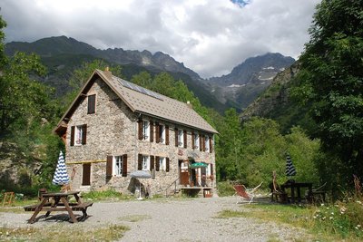
Refuge du Clot Xavier Blanc - Dominique Vincent - PNE HutClot Xavier Blanc mountain refuge
What a strange idea to build this mountain refuge below the road leading to Gioberney, at an altitude of "only" 1397 m. In fact, it was already there more than a century ago, long before the road was built. This simple, sturdy building belonged to the Valgodemar Mining Company that operated in the area extracting copper and lead. When the business closed, the Club Alpin Français bought the building and named it after Xavier Blanc, in recognition of one of the founder members of the CAF, senator of the Hautes Alpes.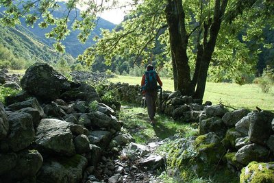
Via Clause du Clot - Dominique Vincent - PNE  Vernacular heritage
Walled paths
On certain stretches of the route, you will walk between two stone walls. Such "via clause" were built to stop the domestic animals, on their way up to the pastures, from walking on or eating the grass in the prairies that was intended for them in the winter. The most remarkable "via clause" is on the way out of the hamlet of Le Clot. It has been restored by the Ecrins National Park.
.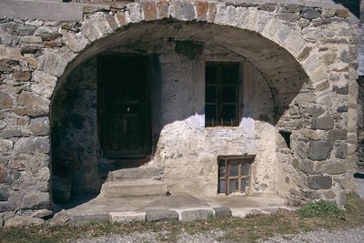
Architecture traditionnelle - Yves Baret - PNE  Architecture
"Toune"
This is an architectural feature of the Champsaur-Valgaudemar area and is the barrel-vaulted porch on the main facade of the house. It sheltered the entrance to the dwelling and stable and was sometimes used to stock items, such as wood, to keep it dry. The "toune" was often painted white to reflect the sunlight. They inhabitants would sit in them to do embroidery or darning, etc.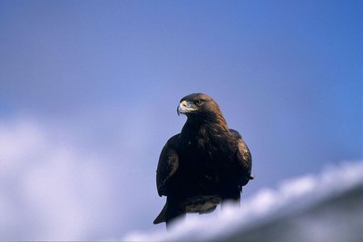
Aigle royal - Robert Chevalier - PNE FaunaGolden eagle
Between La Chapelle and Le Clot, it is not rare to see the golden eagle flying over the sunlit slopes. In the summer, this majestic bird of prey with its dark plumage (some have lovely white rosettes on the underside of their wings) mingles with the short-toed eagle, which is smaller and lighter-coloured, and the griffon vulture, which is larger, with a short tail and often flies in groups. There is nothing surprising about this as the south facing slopes provides thermal lift that enables them to fly high and far.
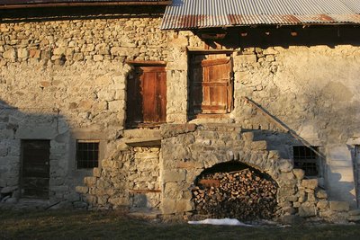
Maison aux portes, Valgaudemar - Stephan D'houwte - PNE ArchitectureTraditional dwellings
A few typical, old Valgaudemar houses can be seen in the hamlets of Casse, Le Bourg and Le Rif du Sap. A few thatched roofs, vaulted entrances to dwellings ("tounes"), and stone paving, are some fine examples of architecture that are worth saving. Cheaper and requiring less maintenance, sheet metal gradually replaced the thatch on the rooftops.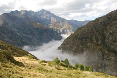
Itinéraire de Tirière vue sur la vallée de Valgaudemar - Olivier Warluzelle - PNE  History
Toponymy in the Valgaudemar area
Valgaudemar! The sound of this name resonates in our ears. Some claim that it is in reference to the valley of Mary "Gaude Marie" or "Rejoice Mary!" It is more reasonable to think that it is in reference to Gaudemar, the last king of the Burgundians (524) a Germanic tribe that invaded this area in 406...Vallis Gaudemarii can be read in texts as early as 1284. Poetic licence, legends and imagination are often red herrings when it comes to researching the origins of names.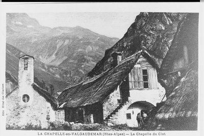
Chapelle et maisons du hameau du Clot avant l'incendie de 1934 - Jean-Claude Catelan (collection) HistoryAn itinerary packed with history
The Casset bridge is the oldest remaining bridge over the Sèveraisse that has not been washed away by floods. On the right bank of this magnificent "Roman" structure, the hamlet of Casset gets its name from the "casse" (large steep scree deposits at the foot of slopes) that surround it. This village, like that of Le Bourg, was partly covered by a landslide. As for Le Rif du Sap, an avalanche swept away the houses from the top of the hamlet in 1944. The hamlet of Le Clot, was flooded in 1928, and was totally abandoned in 1934 when a fire destroyed most of the dwellings.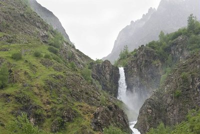
La cascade de Combefroide - Olivier Warluzelle - PNE  Panorama
Waterfalls and view points over the valley
Along the itinerary, you will see the Combefroide and Casset waterfalls that are situated on the south facing slopes of the valley. The route also gives a good view to the east and the west of the Sèveraisse valley from the hamlet of Casset. Downstream, from the hamlet of Rif du Sap, a good example of a U-shaped valley is proof of shaping by the quaternary glaciers.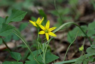
Gagée jaune - Cédric Dentant - PNE  Flora
FloraHayfields
Hayfields surround the village of La Chapelle. Unfortunately, such natural hayfields, and their flowers and insects, are more and more frequently replaced by temporary hayfields, in other words, certain years they are sowed. These prairies are still watered by the irrigation canals that are well maintained by the users with the help of the National Park. You will see the floodway of the Grande Levée canal not far from the stream as it nears the Sèveraisse. The canals are of great importance for preserving wetland flora, such as alternate-leaved golden saxifrage or yellow star-of-Bethlehem, both of which are protected species.
 Know-how
Sundial by Rémy Potey
A real open-air museum piece in the rural landscape, the pictorial art of the sundial aims to foster silence and to be accessible to all. For walkers today and for travellers yesterday. A sundial is a call to reflection and meditation, visible in all its magnificence on religious buildings or carefully hidden, in the little streets of a mountain village. The the Hautes-Alpes department, with its sun-rich climate, has the highest concentration of this example of the people’s art. Today, through the work of the sundial maker Rémy Potey, chamois and golden eagles can be beside the imaginary birds of the mysterious and famous Zarbula, the 19th century Piedmont artist.
Altimetric profile
Sensitive areas
Golden eagle
- Impacted practices:
- Aerial, , Vertical
- Sensitivity periods:
- JanFebMarAprMayJunJulAug
- Contact:
- Parc National des Écrins
Julien Charron
julien.charron@ecrins-parcnational.fr
Bearded vulture
- Impacted practices:
- Aerial, , Vertical
- Sensitivity periods:
- JanFebMarAprMayJunJulAugNovDec
- Contact:
- Parc National des Ecrins - Yoann Bunz- 06 99 77 37 65 yoann.bunz@ecrins-parcnational.fr
Recommandations
It is possible to take a deviation (not on the GR route) past the Refuge Hôtel du Gioberney, following the Sentier du Ministre (add 1 hour 30 mins)

Source

Report a problem or an error
If you have found an error on this page or if you have noticed any problems during your hike, please report them to us here: