7. From La Chapelle-en-Valgaudemar to the Refuge de l'Olan (Stage on the GR54 walking path)
Description
- Stay on the road and cross a mountain stream.
- Immediately on the left, a path leads upwards following the banks of this stream. Take this path and start the ascent with some winding sections among the screes and go on to cross a heather moor. The view gradually opens up onto the Navette valley and the hamlet of Les Portes which lies opposite.
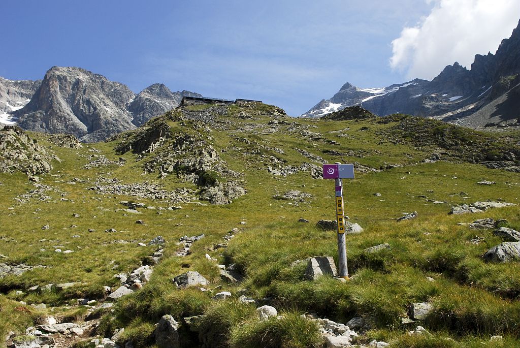
- Cross a stream and then, a few dozen metres further on, at an intersection take the upward-winding path on the right. You reach the montane zone among alpine grasslands, offering a view over the village of La Chapelle and the Refuge de l'Olan. Nearby, an old concrete slab testifies to the passage of an avalanche in the 1950s.
- Departure : La Chapelle-en-Valgaudemar
- Arrival : Refuge de l'Olan
- Towns crossed : La Chapelle-en-Valgaudemar
5 points of interest
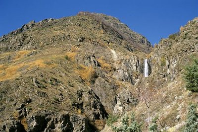
La cascade de Combefroide - Olivier Warluzelle - PNE  Water
WaterCombefroide Waterfall
At the beginning of the path, is a big waterfall that you can approach on a narrow footpath just before climbing the coast. Situated on Combefroide torrent at a rocky escarpment, this waterfall has several projections and presents a total drop of several dozen metres.
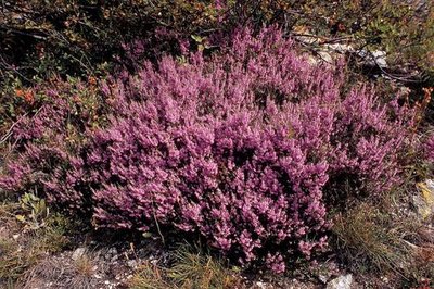
Callune vulgaire - Daniel Roche - PNE  Flora
FloraHeather fields
Over a change in altitude of a hundred metres there is a covering of heather which provides pollen for the bees and purple colour in Autumn, A small persistent shrub with tiny leaves and little pink flowers, it is called Common Heather or False Heather.
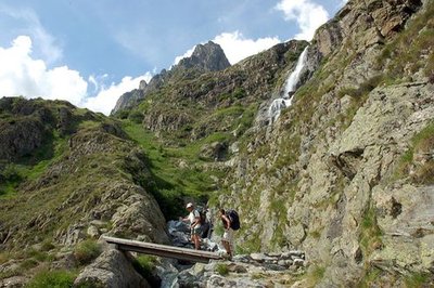
Passerelle franchissant la gorge de la Bourelle - Dominique Vincent - PNE  Geology and geography
Bourelle Gorge
Since the end of the ice age, water has carved the rock and the passage of materials has created a small gorge polishing the base rock (gneiss, micaschists). The National Park has taken on the challenge of building a wooden walkway for walkers to cross this gorge.

 Vernacular heritage
Jas crossing of the Bourelle
Just above the signpost, there are the ruins of a pasture shelter commonly called the, « jas ». Often built using dry stones, this kind of shelter was used to protect the flocks during the summer season.
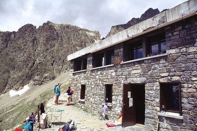
Façade du refuge de l'Olan - Claude Dautrey - PNE  Hut
HutOlan Refuge
Situated at an altitude of 2350 m, this large building constructed in 1957 was carried away by an avalanche two years later. A witness to this is a concrete slab below the refuge. Rebuilt in 1966, it was definitively extended in 1978 with a capacity of 54 places. A stage of the Tour de l'Oisans (GR 54), it welcomes hikers in the summer season and provides a shelter in the winter; it belongs to the Club Alpin Français.
Altimetric profile
Recommandations

Access and parking
Source

Report a problem or an error
If you have found an error on this page or if you have noticed any problems during your hike, please report them to us here: