2. From Claret to Aspres-les-Corps
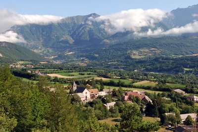
You are plunged into the heart of the agricultural life of this plain, which is sheltered by the rocky Faraut mountain which forms a natural border with Le Dévoluy. Here, the place names take you back in time, and the ruins of the Château de Lesdiguières and the Rocher des Ducs tell us something of a bygone era. As does the Pont du Loup, from which you can gaze north to the Lac du Sautet and south to the Drac river.
Description
- At Le Noyer, go behind the church and continue straight on due north towards the new cemetery until you come to Les Escloutous; then head towards Le Plat and Le Glaizil along a wide, flat track of fine gravel which offers some unobstructed views. At the ford across the Le Plat mountain stream, the track turns into a narrow wooded path. Continue straight on towards Le Glaizil, Le Pinet and Pouillardenc.
- Ford the Rif Manel stream and pass through the hamlet of Pouillardenc. Continue due north until you come to Le Glaizil, then fork right towards La Condamine and Les Meillières. Join the D571 just before the ruins of the Château de Lesdiguières and the museum. Then carry on due north heading towards Aspres-lès-Corps, along a lovely flat and grassy track at the foot of the Rocher des Ducs.
- Before you reach the road, climb uphill towards Boutière following the wooded track. Take a moment to admire the Grande Tête de l’Obiou before dropping down via the road and crossing the Pont du Loup over the Drac.
- At Lapral, take the uphill path on the left leading towards Corps and Grimaudais. On this path, when you are presented with two options always keep right (rockfalls to the left). The path emerges on the road. Here, turn left towards Grimaudais. Then, continue straight on towards Aspres-lès-Corps along a grassy track which turns into a narrow winding path overlooking the Lac du Sautet. Continue straight on until you come out at the holiday centre, La Tuile aux Loups.
This stage can also be followed to La Grange de Brudour. In this case, do not go to Grimaudais but continue straight ahead on the road and cross the N85. When you come to the hamlet of Aspres-lès-Corps, turn right onto the D58 towards the Magnan statue. Leave the D58 at the Brudour turnoff.
- Departure : Le Noyer
- Arrival : Corps or Brudour
- Towns crossed : Le Noyer, Le Glaizil, and Aspres-lès-Corps
5 points of interest
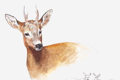
Chevreuil - Pierre-Emmanuel Dequest -PNE  Fauna
FaunaRoe deer
Walnut forests are a favourable home for roe deer. They came from Italy, the Isère and Drôme regions, and were added to some forty animals that were released between 1969 and 1975 in the neighbouring forests of Durbon and Morgon. This timid animal can be recognised by its red-brown coat and white patch on its rear.
 History
Dominique Villars
The botanist Dominique Villars was born in Noyer in 1745. From an early age he was interested in botany, and with his friend, Dominique Chaix, a priest and botanist from Roche des Arnauds, he discovered many new species. He wrote "L'histoire des plantes du Dauphiné" (History of Plants in the Dauphiné), bringing together 3,000 species. Shortly before his death in 1814, Napoleon Bonaparte appointed him botany professor at the Strasbourg Special Medical School.
Village du Glaizil et en arrière plan, Aspres-les-Corps et le hameau de la Broue - Parc national des Écrins - Jean-Pierre Nicollet HistoryVillage of Le Glaizil
The name "Le Glaizil" is thought to derive from the Vulgar Latin term glitia, meaning loam or clay. Like La Fare, Poligny and Le Noyer, Le Glaizil was once part of a district of church- controlled land, that is to say, the Bishop of Gap had joint lordship - and therefore authority - over the land.
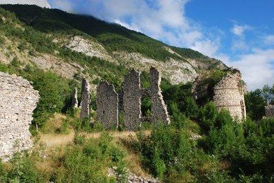
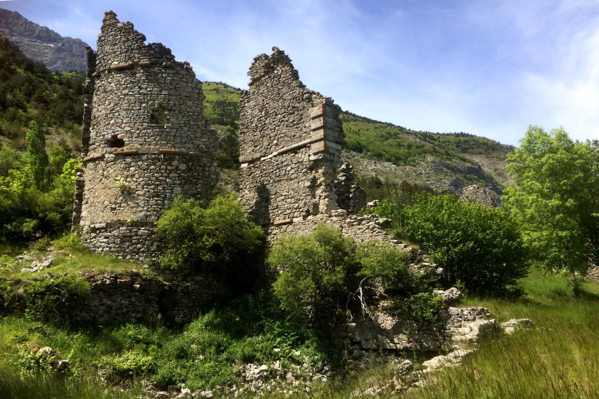
Ruines du château de Lesdiguières - Parc national des Écrins - Jean-Pierre Nicollet HistoryChâteau de Lesdiguières
This château was built in 1580 by François de Bonne, the Duke of Lesdiguières and Protestant leader, on the site of a fortified house owned by his family.
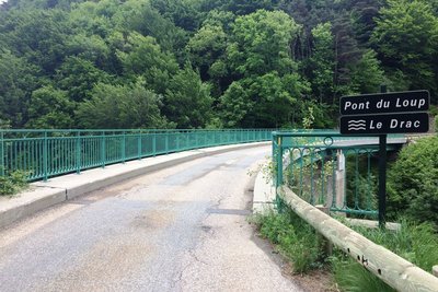
Pont du Loup - Parc national des Ecrins - CDTE05  Vernacular heritage
The "Pont de Loup"
The "Pont de Loup" waterfall was intended to provide the electricity required for the operation of the Gap-Grenoble railway line. The advent of the automobile rendered this project pointless and the Gap-Corps section was never completed.
Altimetric profile
Sensitive areas
Peregrine falcon
- Impacted practices:
- Aerial, Vertical
- Sensitivity periods:
- FebMarAprMayJun
- Contact:
- Parc National des Écrins
Julien Charron
julien.charron@ecrins-parcnational.fr
Recommandations
Rif Manel: enquire about any flooding.
Crossing the Pont du Loup: watch for road traffic.
Path overlooking the Lac du Sautet: narrow, winding, sloping and sometimes slippery.
Crossing the N85: fast-moving traffic!
Together with the Souloise, the Drac flows into the Lac du Sautet, a water sports centre and also a generator of electricity thanks to the dam and its hydroelectric power station, both built in 1922.
In Grimaudais, take a moment to admire the charming chapel and its crowstep gable.
Report a problem or an error
If you have found an error on this page or if you have noticed any problems during your hike, please report them to us here: