7. From Les Marrons to Les Gondouins
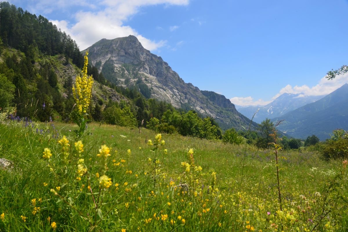
From precipitous paths to forest tracks, you will pass through a variety of landscapes: vast belvederes on the La Coche plateau, alpine pastures, remarkable rocky crags and peaks of the Champsaur. You will experience dizzying views of the valleys and wild banks of the Drac Blanc... Not to mention the rich built heritage encountered here and there along the way.
Description
- Here, before the bread oven, go down hill to L'Horte via shortcuts signposted "Pied du Palastre" and climb uphill again passing through Les Bonnets and Les Jalligons until you reach La Baumette. Then continue straight ahead on the track heading towards Les Richards on the GR50. Ford across the Brudou (shaky footbridge) and then carry on along the GR route which comes out at Les Richards. Go through Les Richards
- Continue to head towards La Coche (mountain biking ("VTT") route). When you leave La Coche, continue straight on towards the visitor area ("Aire d'Accueil") and the plateau (picnicking or bivouacking possible).
- Fork left onto the PR (Petite Randonnée, short-distance trail), just after the car park. At Le Robinet, fork right towards Champoléon along a fine grassy and flat track. This changes into a narrow winding path which drops down into the woods to Les Aryiés and Les Rolands.
- When you reach the Pied des Vignes, turn left towards Champoléon and continue straight on until you come to the car park in Le Clapier. Here, at the back of the car park take the track which leads towards Champoléon and Roche de Bidou. This track is flat, grassy and sandy in places. Follow it along the Drac Blanc until you come to a narrow path climbing uphill on the left (mountain biking ("VTT")). It comes out at L'Iscles des Borels, where there is a picnic area, and after crossing a wide concrete footbridge it leads to the car park in Les Fermonds. Continue straight on along the road until you reach Les Gondouins.
- Departure : Les Marrons
- Arrival : Gondouins
- Towns crossed : Saint-Michel-de-Chaillol, Saint-Jean-Saint-Nicolas, and Champoléon
4 points of interest
 Vernacular heritage
Les Richards
Perched up at an altitude of 1548 m above Pont-du-Fossé in the commune of Saint-Jean-Saint-Nicolas, the village of Les Richards is a haven of tranquillity. The view is breathtaking over the Autanes and the Champsaur woodlands. This is the starting point for a very popular hiking trail around the mountains or to the summit of the Palastre, and a take-off area for long-distance hang-gliders. It is not unusual for a hang-glider to land in Grenoble and sometimes even in Chamonix after a long day's flight from Les Richards! The record is 162 km, with a landing in Chamonix in 2002.
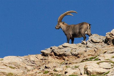
Bouquetin en été - Rodolphe Papet - PNE  Fauna
FaunaAlpine ibex
If you take a few minutes' walk at the end of the valley, you will be able to see some Alpine ibex. In September 1994, in Champoléon, some thirty animals from Vanoise area were released by Ecrins National Park rangers. This superb animal is heavier (100 kg) and less timid than the chamois, and is closely related to the domestic goat. It was almost extinct in the Alps. Today it is totally protected in France and is now safe extinction.
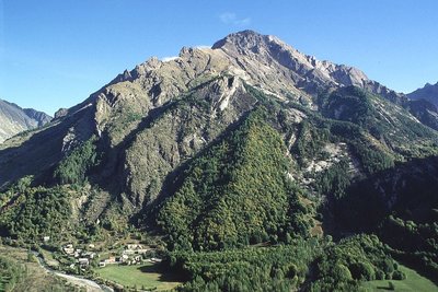
Le village des Borels - Marc Corail - PNE  History
Les Borels
This is most important village in the Chamoléon district (no hamlet bears this name). Until towards the first world war in 1914, the valley lived in a closed circuit for all everyday items. At the Borels there was a weaver (wool and hemp), a miller-baker, an ironmonger, a mason, a breeches-maker and in the other hamlets, a cobbler, two millers, a joiner and two shoemakers. The latter worked from home.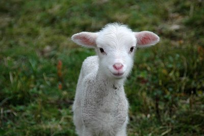
Agneau - Dominique Vincent - PNE  Pastoralism
Tardons
"Tardons" are lambs that are raised on mother's milk in the pastures of the Ecrins massifs. These lambs are celebrated every autumn at the Champoléon agricultural fair. This event spotlights pastoralism and assembles breeders, shepherds and the general public. On the agenda: the sale of sheep, produce market, lamb-based meals and entertainment.
Altimetric profile
Sensitive areas
Peregrine falcon
- Impacted practices:
- Aerial, Vertical
- Sensitivity periods:
- FebMarAprMayJun
- Contact:
- Parc National des Écrins
Julien Charron
julien.charron@ecrins-parcnational.fr
Recommandations
You have to cross a cow enclosure in Le Vernet. In the woods at Les Ariés and along the Drac Blanc, the route is shared with mountain bikers.
At Les Roranches, take a moment to admire the chapel of Saint Pancrace, the oratory, the former school and other features.
On the approach to Les Richards: Caution: overhead cables, then 3 steps and a gate!
Report a problem or an error
If you have found an error on this page or if you have noticed any problems during your hike, please report them to us here: