9. From Orcières (Chauffarel) to Saint-Léger-les-Mélèzes
Leave the Drac and the valley bottom behind as you head to an authentic village-resort, and then climb to a higher level to reach the alpine pasture. Beautiful belvederes and, of course, beautiful larch forests enhance this balcony route.
Description
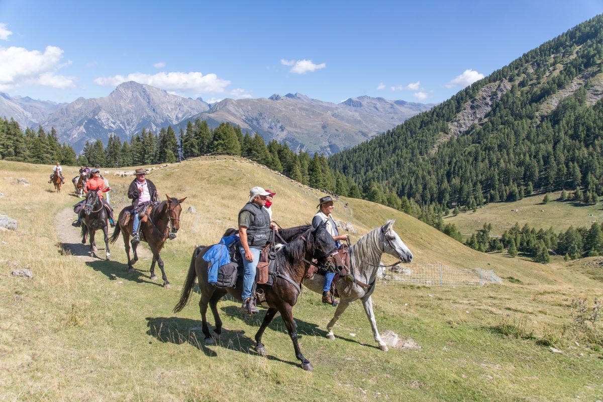
- At Les Trappes, cross the footbridge and then turn left onto the wooded path that rises along the Archinard mountain stream towards Les Audiberts. At Le Pigeonnier, take the level track on the right: a few openings in the trees offer a glimpse of the Grand Pinier above the Orcières-Merlette ski resort. Pass along the foot of the Rocher d'Arthouze, the via ferrata site, and Les Veyrets, a pastoral area. At Serre-Eyraud, continue up the road to the departure point of the village-resort drag lift.
- The path leading towards Mourinou runs through countryside devoted to forest and pastoral activities, and offers more vantage points over the Champsaur valley. At Le Mourinou, go right along the forest track, ford the Combeyron ravine, go through the gate and cross the screes, then go uphill towards Combeau (Cabane de Tante Yvonne). Further on, at the Croix de Vire, the view over the Drac valley and all the surrounding peaks is enthralling...
- Then, take the mountain biking ("VTT") waysigned track to climb up and then down to L'Abeille, from where you can see right across the Champsaur and its farmlands criss-crossed with hedges and trees and the Faraut mountain. The descent to St-Léger-Les-Mélèzes takes you through wide forest tracks, still on the GR50, as far as La Recula.
- At the junction, turn right.
- Take the first track on the left for the end of the journey.
- Departure : Chauffarel
- Arrival : Saint-Léger-Les-Mélèzes
- Towns crossed : Orcières, Saint-Jean-Saint-Nicolas, and Saint-Léger-les-Mélèzes
4 points of interest
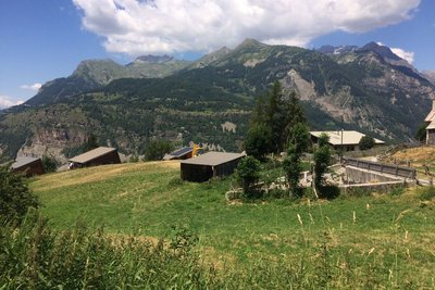
Serre-Eyraud - Parc national des Ecrins - CDTE05  History
Serre-Eyraud
Serre-Eyraud is both a mountain village and a winter sports resort which overlooks
the Champsaur and the confluence of the Drac Noir and the Drac Blanc, 1,450 metres above sea level, opposite the Champoléon valley.
The resort was created in 1962 by a handful of inhabitants: eight runs lead through a larch forest which is exposed to the north, which helps to conserve the snow cover. Serre- Eyraud is the smallest ski resort in the Champsaur valley.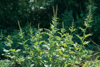
Chenopode du Bon roi Henry - Marcel Chaud - PNE  Know-how
Pastoral plants
Around the shepherds' cabins can be found plants with pale colours that are useful in the kitchen : nettles, which cause rashes, but are used to make delicious soups, wild spinach, also known as Good King Henry , a plant eaten as a gratin (the famous 'oreilles d'âne' (donkeys' ears) dish), with the sour leaves of the Alpine dock. For dessert, the petioles of Monks' rhubarb leaves are served as jams and compotes.
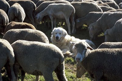
Patou surveillant le troupeau - Jean-Pierre Nicollet - PNE  Fauna
FaunaPatou
The patou is once again being used in the Alpine pastures by breeders and shepherds, following the reintroduction of wolves. Its role is to protect the sheep, not to herd them together like a sheep dog. The dog lives with the sheep from a very young age and considers them as members of its family. It barks and stands between the flock and whatever it sees as a threat. Since it is very protective towards the flock, hikers should make sure they keep their distance.
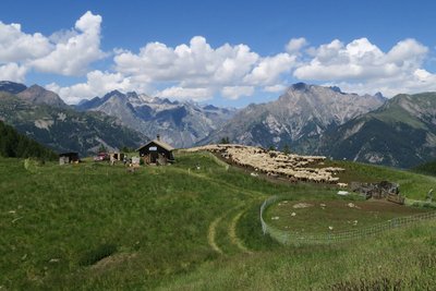
Alpage de Combeau - Parc national des Écrins - Marc Corail  Panorama
The Combeau alpine pasture
The Combeau alpine pasture, lying 2,000 metres above sea level.
Don't miss the superb panoramic view from the Croix de Combeau belvedere.
Altimetric profile
Sensitive areas
Short-toed snake eagle
- Impacted practices:
- Aerial,
- Sensitivity periods:
- MarAprMayJunJulAugSep
- Contact:
- Parc National des Écrins
Julien Charron
julien.charron@ecrins-parcnational.fr
Golden eagle
- Impacted practices:
- Aerial, , Vertical
- Sensitivity periods:
- JanFebMarAprMayJunJulAug
- Contact:
- Parc National des Écrins
Julien Charron
julien.charron@ecrins-parcnational.fr
Recommandations
Do not cut across to the Côtes du Ranc via the Chemin du Facteur: large boulders!
Report a problem or an error
If you have found an error on this page or if you have noticed any problems during your hike, please report them to us here: