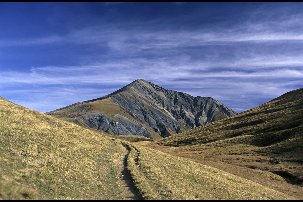
2. From the Pic du Mas de la Grave refuge to the refuges of Les Mouterres and Le Fay
The descent into the Rif Tort valley ends this stage with a little freshness and respite, bringing this stage to a close.
Description
- The footpath splits half-way up. Immediately after a narrow rock bar, do not fork left but continue northwards on the footpath. This leads to an enormous cairn at 2,351m (you have the option of stopping here without climbing to the peak, in which case take the footpath on the left: reference point 3). From this point, the footpath dwindles away, runs along a shaley ravine and crosses short-grazed meadows before joining the screes. Cross some small rock steps to reach the ridge (2,979m). Follow this (vertiginous route) to the summit (3,020m).
- Turn back on yourself, taking the same path in reverse.
- At the cairn (2,351m), take the footpath on the right (ignore the footpath on the left which you followed on the outward route). Cross the stream Le Rachas a little further on and follow the charming Rif Tort valley. A track gradually forms. You pass close to several buildings, but do not leave the main path.
- When you come to an intersection, take the path on the right which heads uphill towards the Col Saint-Georges.
- At the directional signs close to the ruins of the Chalet Josserand, turn left following the GR54 waymarking. Go past the ruins of the Chalet Favre and continue through the alpine pastures until you reach the chalets and mountain stream of Le Rif Tort (2,200m) where there are a number of directional signs.
- Leave the GR54, turning right along the Tour du Haut Dauphiné (GR50-GR54C) footpath. In 15 minutes you come to the chalets of Le Fay and the refuge of Les Mouterres.
- Towns crossed : La Grave, Besse, and Mizoën
2 points of interest
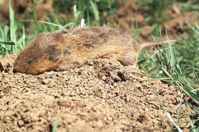
Campagnol terrestre - Eric Vannard - PNE  Fauna
FaunaA “plague” of voles
The European water vole, also called the rat taupier (mole-like rat) in French, is one of the biggest species of voles. Its breeding cycle is such that the species can undergo phases of infestation. Although the causes are not fully understood, this cyclic problem started a few years ago in the valley of La Buffe, at an altitude of 2,000 metres. Although the first signs of the presence of voles in a meadow are undoubtedly the "molehills" they create, when they constitute a plague, they can completely overturn the earth, which could be mistaken for ploughed land.
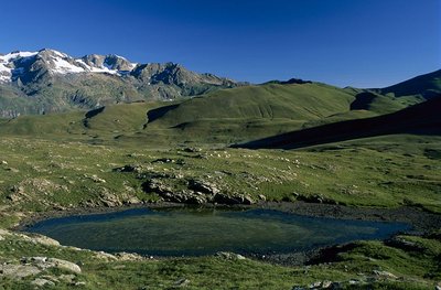
Zones humides du Rif Tort - © Parc national des Écrins - Jean-Pierre Nicollet  Flora
FloraThe wetlands of the Rif Tort
Temperatures on the Emparis plateau are characteristic of a cool steppe climate. It is a very windy plateau with an average annual temperature only just above zero degrees. Winter lasts for eight months, during which it freezes almost every day. The particularly severe temperature constraints in the Rif Tort catchment area have favoured the maintenance of a relic flora adapted to these extreme conditions since the last ice age. «Arctic-Alpine»plant formations are found here. This is a relic flora inherited from advancing glaciers in the Quaternary period, comparable to the flow found on the coasts of the Far North. These formations are particularly rare in Europe and are of very high heritage value. You might see numerous protected species here: bicoloured sedge, sweet grass (a boreal relic species, sole colony in Isère) and the sago pondweed. Livestock grazing in the marsh is necessary because it limits the development of herbaceous plants which could squeeze out the Arctic-Alpine species. A delicate balance needs to be found between the trampling likely to destroy the plant species growing in the low marshes and the passage of the flocks to encourage rejuvenation of the area, and thus maintain this habitat.
Altimetric profile
Recommandations
Information desks

Oisans Park house
Rue Gambetta, 38520 Le Bourg d'Oisans
Video presentation of the natural resources of the Oisans mountain and its crafts. Information, documentation about the Park, projections, reading space for children. Accessible to people with reduced mobility. Free admission. All animations of the Park are free unless otherwise stated.

Tourist information office of La Grave
RD1091, 05320 La Grave
Opening hours:
- May to mid-June: from Tuesday to Saturday from 9 am to noon and from 2 pm to 5 pm.
- Mid-June to mid-July and mid-August to mid-September: Monday to Saturday from 9 am to noon and from 2 pm to 5.30 pm.
- Mid-July to mid-August: every day from 9 am to noon and from 2 pm to 5.30 pm.
More information
Source

Report a problem or an error
If you have found an error on this page or if you have noticed any problems during your hike, please report them to us here: