From the refuge of Le Chardonnet to Le Lauzet
Névache MediumDifficulty
5. From the refuge of Le Chardonnet to Le Lauzet
4h
Duration8,7km
Distance+428m
Positive Elevation-1001m
Negative ElevationStage
Course typeNetwork
Embed this item to access it offline
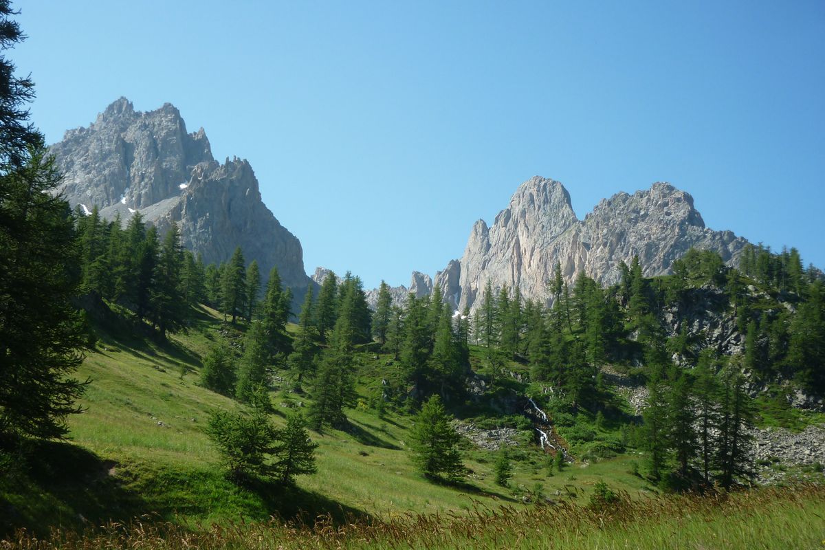
Shortly after skirting around the glacial rock bar of Le Chardonnet, the valley suddenly flattens out into a vast wetland area, the relic of an ancient lake now filled in. The footpath then climbs gently, leading to the Guisane valley. After taking in the astonishing landscapes, the hiker comes to the idyllic alpine pasture of L'Alpe du Lauzet overlooked by the eponymous needle and the vast cliffs of Roche Robert and Roch Colombe. A small corner of Paradise where ibex are never far away!
Description
From the shelter of Le Chardonnet, follow the footpath across this grassy flat area until it splits into two at the footbridges (signed).
- Cross the footbridge on the right and climb up this small steep rise. The path leads past the Lac du Châtelard. It is mainly grassy and runs past boulders on the left and marshy areas lower down. It runs uphill more steeply for a short stretch before levelling out. It then leads on gently to the Col du Chardonnet (2,638m). The descent starts off along some stony terrain, and then leaves the GR57 which leads away along a balcony route.
- After a few steep, overhanging stretches, the footpath winds above the valley. At 2,200 metres, the footpath joins the footpath leading down from the Col de la Ponsonnière and they run together to form one good path following the Rif at first and then running through a boulder-strewn alpine pasture.
- The path arrives at a point above the chalets of L'Alpe du Lauzet (signed) which it leaves on its right to continue towards the valley. Follow the footpath running along the banks of the mountain stream and then drop downhill to the road and the Pont de l'Alpe.
- Departure : Chardonnet shelter
- Arrival : Le Lauzet
- Towns crossed : Névache and Le Monêtier-les-Bains
1 point of interest
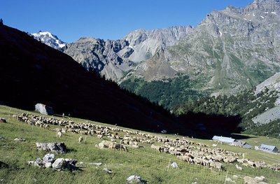
Troupeau de brebis à l'Alpe du Lauzet - © Parc national des Ecrins - Jean-Pierre Nicollet  Vernacular heritage
L'Alpe du Lauzet
L'Alpe du Lauzet is a mountain village at an altitude of 1,940 m, below the Aiguillette du Lauzet, which reaches 2,717 m, in the region of Monêtier-les-Bains. The village is aligned at mid-slope to avoid the avalanches that regularly fall into the bottom of the valley. The handful of houses were once used as summer pasture homes for the inhabitants of Le Lauzet in the Guisane valley. On the chapel door, a plaque recounts that five people were buried alive by an avalanche during the winter of 1892.
Altimetric profile
Sensitive areas
Along your trek, you will go through sensitive areas related to the presence of a specific species or environment. In these areas, an appropriate behaviour allows to contribute to their preservation. For detailed information, specific forms are accessible for each area.
Alpine ibex
- Impacted practices:
- Aerial, , Land, Vertical
- Sensitivity periods:
- JunJulAugSep
- Contact:
- Parc National des Écrins
Julien Charron
julien.charron@ecrins-parcnational.fr
Alpine ibex
- Impacted practices:
- Aerial, , Land, Vertical
- Sensitivity periods:
- JunJulAugSep
- Contact:
- Parc National des Écrins
Julien Charron
julien.charron@ecrins-parcnational.fr
Alpine ibex
- Impacted practices:
- Aerial, , Land, Vertical
- Sensitivity periods:
- JunJulAugSep
- Contact:
- Parc National des Écrins
Julien Charron
julien.charron@ecrins-parcnational.fr
Peregrine falcon
- Impacted practices:
- Aerial, Vertical
- Sensitivity periods:
- FebMarAprMayJun
- Contact:
- Parc National des Écrins
Julien Charron
julien.charron@ecrins-parcnational.fr
Golden eagle
- Impacted practices:
- Aerial, , Vertical
- Sensitivity periods:
- JanFebMarAprMayJunJulAug
- Contact:
- Parc National des Écrins
Julien Charron
julien.charron@ecrins-parcnational.fr
Source

Parc national des Ecrinshttps://www.ecrins-parcnational.fr
Report a problem or an error
If you have found an error on this page or if you have noticed any problems during your hike, please report them to us here: