From the Buffère shelter to the shelter of Le Chardonnet
Névache MediumDifficulty
4. From the Buffère shelter to the shelter of Le Chardonnet
2h30
Duration7km
Distance+443m
Positive Elevation-281m
Negative ElevationStage
Course typeNetwork
Network
Embed this item to access it offline
A forest path leads to the valley bottom, where you rejoin the Clarée. Clarée, it is aptly named. Its pleasant river banks and its coolness are a welcome relief in the summer. This tempestuous water course with its ever-shifting reflections is a paradise for trout, anglers and a diversity of wildlife drawn by its pure waters. Further up the valley, the larches are overhung by the peaks of Les Cerces, ochre- and red-tinted cliffs and jagged peaks of limestone.
Description
From the refuge, follow the GR down towards the valley, pass a first alpine pasture and then a second (Le Serre); the footpath then runs into the forest. The path is made up of stones which can sometimes be slippery.
- At the bottom of the descent, leave the GR57 and fork directly left towards the chalets of Basse Gardiole and La Meuille (signed). Go across the narrow wooden footbridges and the footpath comes out onto a large clearing with chalets on the right. The path continues, running close to a water course, and passes close to a bridge, the Pont de la Souchère. Do not cross the Clarée. Stay on the right-hand bank and continue towards the Pont de Lacha and La Meuille along a good path (signed). A short distance beyond the chalet of La Meuille, the path splits into two at a wooden gate. Here, stay on the right-hand path to see the scenic Fontcouverte waterfall. Stay on the footpath following the water course until you come to the restaurant La Fruitière and the Fontcouverte campsite.
- The path then runs through this campsite for a short distance, to join the uphill path to the refuge of Le Chardonnet (signed). The footpath climbs directly up to the chalets of Laraux. Carry on along the GR57.
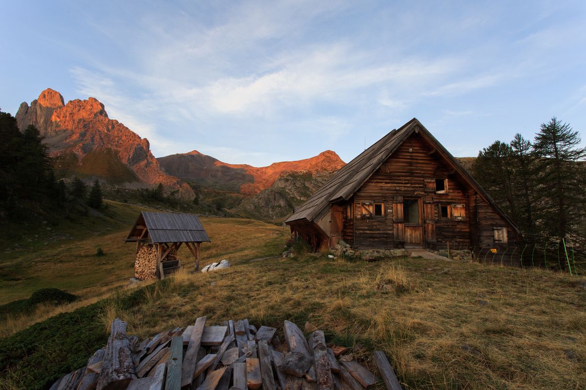
- After a few steeper stretches, it runs into the forest for a short distance. At the footbridge, the landscape opens out and the shelter finally comes into view, perched atop a small promontory offering a magnificent view. This section is easy.
- Departure : Buffère shelter
- Arrival : Chardonnet shelter
- Towns crossed : Névache
Altimetric profile
Recommandations
Even though there are frequent stretches through the forest, sun cream is essential.
The detour to admire the Fontcouverte waterfall is really worth the effort!
The detour to admire the Fontcouverte waterfall is really worth the effort!
Information desks

Tourist information office of La Clarée
Hameau de Ville-Haute, 05100 Névache
Information about hikes, accomodation, activities, events, shops and amenities.
The office welcomes you from Monday to Saturday , from 9 a.m. to 12 p.m. and 1:30 p.m. to 5 p.m all year. The office is open every day during the summer holidays
The office welcomes you from Monday to Saturday , from 9 a.m. to 12 p.m. and 1:30 p.m. to 5 p.m all year. The office is open every day during the summer holidays
Source

Parc national des Ecrinshttps://www.ecrins-parcnational.fr
Report a problem or an error
If you have found an error on this page or if you have noticed any problems during your hike, please report them to us here: