2. From Le Domaine to Gap Bayard
Description
- At the top, it's worth taking a left turn back to Lac de L'Aulagnier.
The route returns and continues towards Saint-Julien. The track is very pleasant and leads to the road at Le Chanet, a charming, well-restored hamlet. On the Champ Rouy road, pass the remarkable fountain, communal oven and chapel and continue straight ahead. - Before leaving the village, take the grassy track leading down through the woods (mountain biking ("VTT") sign).
- When you reach Saint Julien-en-Champsaur, go down to the left and then turn left again in front of the church, onto the Route de Chantaussel. Continue straight on, pass a first oratory (Rue des Oratoires) along a track which leads to a second oratory and the Route de Saint-Julien (D15). (Caution, fast-moving traffic!). Carry on along the D15 until you come to a junction (D15 roadsign).
- Descend towards Ferme des Pommiers and immediately cut across a grassy track that descends to the right. Join the road right, continuing straight on until you reach La Coustoune.
- Here, turn left onto the Chemin du Clavi (mountain biking "VTT" trail) heading towards Chabottes, along a good flat track. The track comes out onto a Y-shaped road (at Les Fouents): go straight down past the few houses in the hamlet of Les Roberts.
- Take the track on the left, pass l'Ariey and follow the signs for Saint-Julien.
Take the first turning on the right down the Riou Mort onto the chemin des Vilettes, then the first turning on the left onto the chemin des Ribières, which leads to the moulin de Chabottes. - Go down the D43A and take the Chabottes bridge to cross the Drac.
- After the Pont du Drac leisure centre, turn left towards Les Olliviers.
Take the first right and go straight on until you reach the D944. Cross it and take the small road opposite. This becomes a forest track on the left and climbs steeply beyond the Pont-du-Fossé canal. The climb leads to another level track: go straight on and cross the route de Saint-Léger to continue straight ahead on a track that climbs to Le Bouscatu (meaning ‘wooded place’). - At Bouscatu, follow the signs for Are. The track, which is smooth and level, then continues along the canal, offering shady tunnels of greenery. The canal crosses the mountain below the Col de Manse and reappears near the Lac des Jaussauds, then continues on to Charance, a distance of 12km. At Are, the horses quench their thirst at the ford in the talweg. Continue straight on towards the Champ de Moïse. At the junction with the Eyrauds track, continue straight ahead, still following the canal.
- At the junction with Les Communs track, turn left onto the level track and then immediately right onto a path that descends and forks left. The path joins a new track, suitable for vehicles, at a bend in the road at Les Communs.
Continue downhill until you reach Grand Pièce, where you turn left onto a straight track that invites you to gallop before reaching the D514 road.
At the road, turn right to reach Appaloosa Farm and the Pont de Frappe bridge.
Cross the bridge to cross the Ancelle torrent and turn right along the D114 towards Saint-Julien until you reach ‘La Ligne’ (an aborted railway project) on the left. - It's well worth stopping at the landscape table: a beautiful viewpoint with historical explanations of the landscape.
Fork off (PR) towards the car park, continue on the track then cross the small road and continue straight ahead, still on La Ligne. The track is now wide and flat, offering views of the Chaudun and Chaillol mountains. At the Riou Gras bridge, you can take a path down to admire the bridge from below.
Further on, you can pass under ‘La Bâche’, an overhead metal canal crossing the La Ligne trench.
At the track junctions (Chemin des Morts and next), continue straight ahead. - At Serre-Richard, information panels explain the history of La Ligne.
Cross the Avenue de la République then continue on the road that climbs up opposite.
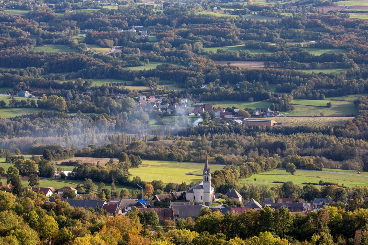
At Grand Champs, you can see Saint-Laurent-du-Cros, which has a church (burnt down by the Duke of Savoy's troops in 1692, rebuilt in 1829 and enlarged in 1884) and a Protestant church (1886).
Continue straight ahead on the Chemin des Forestiers.
The track comes out at a bend in the road: follow it to the right.
Cross the road (continuation of the Chemin des Forestiers) and continue straight ahead on the track that climbs and continues on a section of road (track on the IGN map) that offers fine views of the Pic de Gleize and the agricultural landscape. - At the mountain bike and PR junction, turn 90° right onto a wooded track and, at the Y junction, turn left (sheep grazing area).
The grassy (but rutted) path leads to the crossroads of the Via de Gap tracks: follow the signs for the Gap-Bayard oxygenation centre along a dirt track that leads into the Bois de Saint-Laurent, a remarkable beech forest!
When you reach the end of the road, follow the PR on the left-hand side of the track: you'll pass the Campallon hut and then the wet peat bogs of Sagne Staïse (information panels on the rare plant species whose pollens have recorded changes in climate and the succession of cultivated plants over the last 6,000 years) and Sagne de Canne (yellow panel, ignore the white panels). - At Sagne de Canne, leave the mountain bike track and continue along the road which descends to the left. At the Cabane Roussel, turn left down the road towards Gap-Bayard.
- Leave this road at the junction to follow the Bayard forest road to the left, which takes you through wooded fairways across the golf course on the Bayard plateau. Stay on the main track, following the running circuit. Finally, return to the car park through the undergrowth that runs alongside the main road.
- Departure : Le Domaine
- Arrival : Gap Bayard
- Towns crossed : Saint-Bonnet-en-Champsaur, Saint-Julien-en-Champsaur, Buissard, Chabottes, Forest-Saint-Julien, Saint-Laurent-du-Cros, and Gap
3 points of interest
 Architecture
Protestant Church of Saint-Laurent du Cros
This is the only Protestant church in the Champsaur and it witnessed the dark period that followed the Revocation of the Edict of Nantes in 1685. Today, with the religious wars firmly in the past, this building is a place of worship and assembly for the valley's Protestants.
Prior to 1685, there were three Protestant churches in the territory, in Saint-Bonnet, Orcières and Ancelle. At that time, when the Duke of Lesdiguières, Jean-François de Bonne, was extending his rule over the Champsaur, Protestants represented a significant proportion of the population. Since this major figure was also the leader of the Protestants, forced conversions were common. But when Louis XIV decided to revoke the Edict of Nantes, all over France pastors were hanged, shot and sometimes sent to the galleys, and Protestant churches were destroyed. In 1789, freedom of religious practice was finally restored.
In the valley, it was not until 1834 - and a ministerial order allocating the sum of one thousand francs for this purpose - that a new church for adherents of the Reformed Church was constructed. But by 1880 the building had become too small and a new church, inaugurated on 26 May 1886, was constructed on its present site, provided by Mr Victor Cesmat.
In 2003 significant restoration work was carried out by the municipality on the entire building.
 Fauna
FaunaMouflon
If you make a detour to the Col de Gleize, you may well see some mouflons. An ancestor of the sheep with ammonite horns, it was introduced from 1949 into the Alps from herds in Corsica and central Europe, and seems well settled in the Chaudun area. Even though the European Union recommends strict protection of the mouflon, it is still hunted during the hunting season. Its populations are ill-adapted to extreme Alpine conditions and can fluctuate according to the winter weather.
 Panorama
Bayar golf course
The Gap-Bayar golf course is located at an altitude of 1,250m. In the view of specialists, it is one of the finest golf courses in the south of France. The 18-hole course is surrounded with forests filled with wild fruit, mushrooms and wild animals. Near the pastures, where the cows graze, there is a clear view over the Champsaur, the Ecrins and the town of Gap.
Altimetric profile
Sensitive areas
Short-toed snake eagle
- Impacted practices:
- Aerial,
- Sensitivity periods:
- MarAprMayJunJulAugSep
- Contact:
- Parc National des Écrins
Julien Charron
julien.charron@ecrins-parcnational.fr
Short-toed snake eagle
- Impacted practices:
- Aerial,
- Sensitivity periods:
- MarAprMayJunJulAugSep
- Contact:
- Parc National des Écrins
Julien Charron
julien.charron@ecrins-parcnational.fr
Report a problem or an error
If you have found an error on this page or if you have noticed any problems during your hike, please report them to us here: