Tour of Pic de Valsenestre
Valjouffrey MediumDifficulty
Tour of Pic de Valsenestre
5j
Duration44,7km
Distance+2576m
Positive Elevation-2589m
Negative ElevationMulti-day trekking
Course typeEmbed this item to access it offline
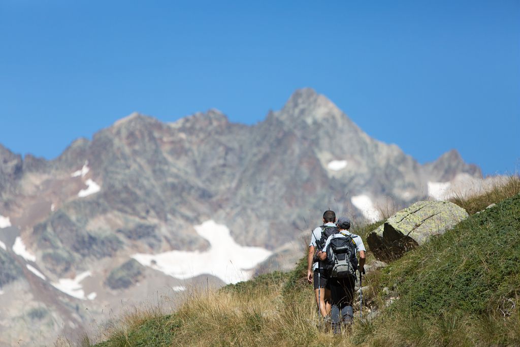
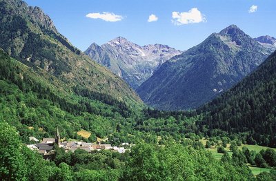
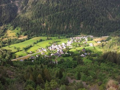
Five hamlets, home to 130 permanent inhabitants, a high-altitude refuge nestling against the foot of a slender north face, forests, meadows, mossy scree, alpine meadows, granite peaks and needles, névés... Take the Pic de Valsenestre tour is discover an exceptional area with a wide variety of landscapes.
5 steps
Description
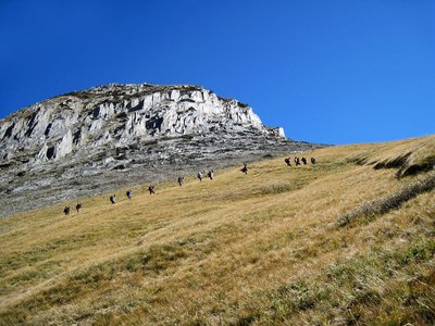
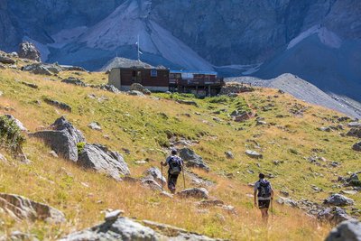
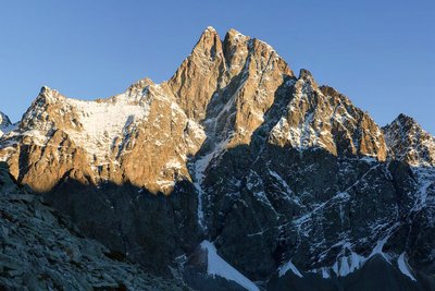
The entire Tour du Pic de Valsenestre takes place in a single commune : Valjouffrey. The first stage of this itinerary links the hamlet of La Chapelle-en-Valjouffrey to Valsenestre in less than two hours, along the left bank of the Torrent du Béranger. After a night in Valsenestre, you'll reach Le Désert-en-Valjouffrey. Agriculture and tourism keep this remote hamlet, where home to around twenty permanent residents year-round. The route follows the GR 54 over the Côte Belle pass (2290 m). On the way up, you'll come across the spectacular flakes of the limestone columns of Valsenestre. At the pass, you'll enjoy splendid views of Le Rocher de la Muzelle and the surrounding peaks. The third day takes you from Désert-en-Valjouffrey to the Font Turbat refuge. A gently sloping path winding through meadows takes you in 1h30 to the cascade de la Pisse. From here, the path becomes a footpath. You soon discover a characteristic glacial valley and the imposing north face of L'Olan, which will accompany you on the slow ascent to the refuge. The fourth day takes you back to the Désert via the wild route of the Petit Vallon. From the refuge, you climb up to the Col des Lauvets, which opens up a view of the route back to Le Désert and the Font Turbat valley. Take one last look at L'Olan before starting your descent. The last day of your journey will take you, in a more pastoral and bucolic atmosphere, to La Chapelle-en-Valjouffrey, after passing through the hamlet of Les Faures and crossing that of La Chalp. It's back to life on the valley floor.
- Departure : La Chapelle-en-Valjouffrey
- Arrival : La Chapelle-en-Valjouffrey
- Towns crossed : Valjouffrey
Altimetric profile
Recommandations
Two passages of over 2000m high : please check access conditions before setting off.
Reservations are recommended if you wish to sleep in a refuge.
Reservations are recommended if you wish to sleep in a refuge.
Is in the midst of the park
The national park is an unrestricted natural area but subjected to regulations which must be known by all visitors.

Information desks

Maison du Parc du Valbonnais
Place du Docteur Eyraud, 38740 Entraigues
Reception, information, temporary exhibition room, reading room and video-projection on demand. Shop: products and works of the Park. Free admission. All animations of the Park are free unless otherwise stated.
Transport
Access and parking
From Entraigues, take the D117 towards “Valjouffrey”. La Chalp-en-Valjouffrey is the third hamlet after Entraigues.
More information
Source

Parc national des Ecrinshttps://www.ecrins-parcnational.fr
Report a problem or an error
If you have found an error on this page or if you have noticed any problems during your hike, please report them to us here: