Pic Coolidge (3,775m)
Saint-Christophe-en-Oisans HardDifficulty
Pic Coolidge (3,775m)
2j
Duration22,4km
Distance+2038m
Positive Elevation-2038m
Negative ElevationMulti-day trekking
Course typeGrade F+ (35° on snow and II/III on rock), long mixed climb (snow/rock) with some rocky stretches of moderate difficulty, no crevassed glacial terrain.
Embed this item to access it offline
This peak is one of very few itineraries suitable for a discovery of alpinism in all its dimensions: refuge or bivouac, snow, rock, route-finding. But above all it yields the secrets of the incredible architecture of these high places, invisible from the valley below.
2 steps
Description
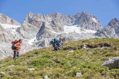
To get to the Temple-Écrins refuge, you have to walk along the Vénéon, up through the Carrelet wood and climb a few stone steps before the landscape gradually opens up. At the end of the path, the refuge comes into view.
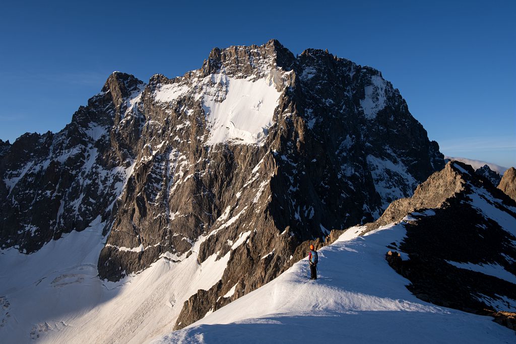
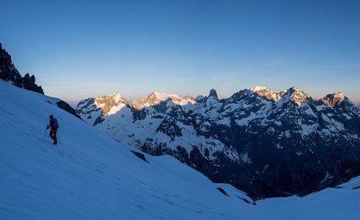
On the second day, we get to the heart of the matter with the ascent of Pic Coolidge. Leaving the refuge, you first reach the Col de la Temple-Épaule at 3,321m. You then have to climb 450m to reach the summit of Pic Coolidge at 3,775m.
Return to La Bérarde via the same route.
On the second day, we get to the heart of the matter with the ascent of Pic Coolidge. Leaving the refuge, you first reach the Col de la Temple-Épaule at 3,321m. You then have to climb 450m to reach the summit of Pic Coolidge at 3,775m.
Return to La Bérarde via the same route.
- Towns crossed : Saint-Christophe-en-Oisans and Vallouise-Pelvoux
Altimetric profile
Recommandations
The round trip from La Bérarde with an overnight stay at the Temple Écrins hut is the easiest and least demanding, but also the most popular. It is recommended for those with a little experience. However, it is a long normal route, the speed of which is closely linked to the snow cover on the scree. In summer, the rocky parts of the route are well marked with crampons and cairns, which makes it easy to follow the correct route. At the end of the rocky section, be sure to mark the spot that will help you find the right route on the way down.
A very early start (at night) is recommended. To get the most out of this race, it is essential to be well trained and used to long walks.
A very early start (at night) is recommended. To get the most out of this race, it is essential to be well trained and used to long walks.
Standard equipment for snow and mixed itineraries, not including glacial terrain: telescopic poles, crampons, ice axe, helmet, harness, 30m climbing rope, belaying and progress equipment, 30-litre bag, warm clothing, safety kit etc.
Is in the midst of the park
The national park is an unrestricted natural area but subjected to regulations which must be known by all visitors.

Information desks

, 38520 Saint-Christophe-en-Oisans - La Bérarde

Oisans Park house
Rue Gambetta, 38520 Le Bourg d'Oisans
Video presentation of the natural resources of the Oisans mountain and its crafts. Information, documentation about the Park, projections, reading space for children. Accessible to people with reduced mobility. Free admission. All animations of the Park are free unless otherwise stated.
Access and parking
From Le Clapier, which is accessible from Le Bourg d'Oisans or Briançon via the D1091 (4km south-east of Bourg d'Oisans), follow the D530 up the Vénéon valley for 26km to La Bérarde. At the entrance to the village, cross the bridge over the Étançons stream and go down a narrow road to park in the car park below the village.
Parking :
Bérarde car park
More information
Source

Parc national des Ecrinshttps://www.ecrins-parcnational.fr
Report a problem or an error
If you have found an error on this page or if you have noticed any problems during your hike, please report them to us here: